Thursday, June 28, 2012

Back in Mile High

Its Thursday evening - June 28th.
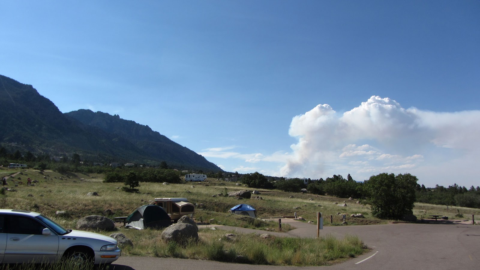
We left C-Springs yesterday and made the short drive north to Golden,
Colorado - our home for Weds & Thursday nights.

My good friend Frank & his wife Sandy live here and is always the highlight
of our visit.   Frank and I go back almost 40 years and was the reason for my
move to Colorado back in the 70's.

We had dinner at Franks house last night and then today picked him up
for a day of reminiscing and hitting some of my old mountain haunts.

First on the agenda was a trip up Mt. Evans.
Mt. Evans is a scenic mountain about 25 miles west of Denver and rises to over
14,000 feet.  You can drive to the top on the narrow and twisting roads and on 
a clear day be rewarded with views that stretch out to forever.


On the way up it got cloudy and started to rain, snow, and lightning.


Mountain Goats dot the hillsides... and sometimes the roadways!


At the top we posed for some pictures while being snowed upon


You can see the road we took up way down below.

Back in my younger days I used to drive up near the top and then set off across the
high country backpacking for a few days.
I spent many a peaceful night on the slopes of Mt. Evans.


After our visit we decended back down to lower elevations (8,000' or so)
Had a nice lunch in Idaho Springs, then headed over to Central City and Blackhawk.

Central City, an old gold mining town, was to be the capital of Colorado but
soon the wives of the newly rich miners decided that they would rather live
down in Denver where the winters were much less severe.

So...  the money headed down to Denver and the rest is history.


Down a short gulch from Central City is the sister mining town of Blackhawk.

Blackhawk was a sleepy little town until the State in it's infinite wisdom
decided to turn it into a Gambling Destination.
Now it has 30 story hotels and casinos.

It was a culture shock for me.  The last time I was here I would pan for gold in
the stream.   Now all the gold is on the Blackjack table.


Heading back to Denver on I70 you pass the "Jetson House" (my name)
It is a futuristic house built on the side of a mountain overlooking the interstate.
The house was used in the filming of Woody Allens "Sleeper"

Tomorrow Paul arrives and we head out to Yellowstone and points north.
His flight arrives around 3:45pm so I plan on a 3 1/2hr drive to Rawlins, Wy
tomorrow and then 5 1/2hrs to Jackson, Wy on Saturday.

We are looking forward to his return visit and more fun in one of the greatest
places on the planet...

Yellowstone National Park.

See ya there!


Tuesday, June 26, 2012

Good by Flying W Ranch

Many moons ago, when I was knee high, my father would pack up the station wagon
load up the family, and hit the road for points west.
Our travels each year would last most of the summer and cover many many miles.

Much of those trips have been lost in the fog of the years but one memory that
survived was a night spent in the Garden of the Gods and at the Flying W Ranch.

The Flying W - a Colorado Springs institution  - was a working
 cattle ranch, that for the last 60 years has also worked
at preserving a bit of the old west cowboy heritage.

It was a large complex with dozens of buildings, museums, animals, wagons,
and precious artifacts from the cowboy era.

A visit to the ranch at supper time meant an authentically prepared chuck wagon 
dinner, and a western show by The Wranglers, the second oldest Western singing
Group in the world.

The Wranglers play simple western standards about cattle drives,tumbleweed
 and sagebrush, songs like Rawhide and Ghost Riders in the Sky,
 but they are also accomplished musicians in the bluegrass arena.

During a rendition of Ghost Riders I remember a headless horseman riding past
our tables in the night with a flaming torch.
This was the type of show you could expect at the Flying W.

I looked forward to our current visit to Colorado Springs in no small part due to the
fact that I had wanted to share with Kate a trip to the Flying W.
I had planned to go there for supper last night but it was closed due to smoke
from the Waldo Canyon Fire.

Today, just as we returned from our photo taking of the aircraft fighting the fires
the wind shifted to the worst possible direction, and increased to over 60mph.
This unexpected event turned this bad fire into a monster!

The fire jumped the ridge that we had been photographing and rushed into the valley
taking out everything in its path.

I'm sad to say that tonight the Flying W and all of its buildings
burned to the ground!

As I write this the local news reports are showing images of entire neighborhoods
that are being burned.  The number of homes lost will be high.

Presently over 32,000 people have been evacuated and more subdivision evacuations are 
being announced right now. 

The night sky to the northwest has an eerie reddish tint... 
The air outside of the coach is loaded with thick smoke that irritates the eyes & throat.
 Where the fuel for the flames perviously was pine trees, 
the fuel is now homes.

It's a sad night in Colorado Springs.


The Waldo Canyon Fire

The Waldo Canyon Fire, as the fire here in Colorado Springs is named, continued 
to burn today, belching alternating clouds of white, and then dense, black smoke.

We woke up to a foggy smoke filled world but as the day progressed the
winds picked up strongly from the South, as they have the past several days, and
the winds blew the smoke away.

The fire has now burned over 5,000 acres.  For reference, one square mile is
640 acres so we are talking almost 8 square miles of forest that has burned so
far and the fire is only 5% contained.

A wider view of the fire.


The black smoke is indicative of heavy timber burning.
The crowns of the pine trees flare up - their sap burning instantly like a torch
sending orange flames and black smoke billowing skyward.


All types of Aircraft are flying low - at treetop level.

The helicopters scoop up water at nearby reservoirs and dump it at
pin point locations.


The fixed wing aircraft which include the Big Boys - The C130's - lay
down fire retardant which is colored red in order for the pilots
to see where their load dropped allowing them to adjust their flight
path on the next pass.


Below is a video we shot today of some of the Aircraft doing their work.


If the video does not show up in your email,

Click or copy/paste the link below to view it in UTube: 

 http://www.youtube.com/watch?v=ikLQ_eLePb0


The weather here has been hellish!

Sunday we set an all time high temperature record in C-Springs  100 degrees...
Not a record high for the day - but the highest temperature ever... 

Monday we tied that new record.
Today we set a new all time high of 101.

Thru this all the winds have been blowing gusts in the 30's fanning the flames.
Not good weather for fighting a forest fire.

A cumulus cloud is one of those puffy white clouds that you get on a nice day...
They are formed by rising warm air currents.

The white cloud behind the smoke in the picture below is called
a pyrocumulus cloud.

It is formed from the intense heat of the burning forest.


Tomorrow we pick up camp again and head north 70 miles to Denver.
I've just heard on the news that a new fire has broken out just west of Boulder
which is 20 miles N of where we will be.

We need some rain!


Monday, June 25, 2012

And when the Griswolds arrived at Wallyworld.... Wallyworld was Closed!

The fires continue...
We watch the local news for some sign that we will be able to see the sights,
but unfortunately it does not look good.

Making the fireman's work all the more difficult, the temps were again over
100 degrees, the afternoon winds shook the coach, and the humidity
is remaining in the single digits.

You can see the smoke plume from our campsite


With temps over 100 degrees Kate takes a nap...
Yet she still has a sweatshirt on!


Our site overlooks the plains and the city of Colorado Springs


On a sad note:
We received word this morning that Kates Uncle Buddy passed away yesterday.

Buddy was a special guy.
Our times together were special.
He loved his niece and she loved him.

The sad irony of life is that we must accept the sorrow of losing someone 
if we are to experience the joy of loving them.

You'll be missed.
Rest in peace Buddy!


Sunday, June 24, 2012

Colorado is Burning!

Today we drove 6hrs from Durango to Colorado Springs.

Our route took us over the famous (or infamous) Wolf Creek Pass..
Those of you who are ex-truckers like me certainly remember the CW MCall
Song about the pass
Me an' Earl was haulin' chickens on a flatbed out of Wiggins,
 and we'd spent all night on the uphill side of thirty-seven miles of hell 
called Wolf Creek Pass. Which is up on the Great Divide

What... no ex-truckers out there!

Anyway - we arrived at our new home for the next 3 nights...
Cheyenne Mountain State Park...  on the Eastern Flank of Cheyenne Mountain
overlooking the city of Colorado Springs.

The view is wonderful from our camper!

If Cheyenne Mountain sounds remotely familiar, that is because it is the secret,
or not so secret - Air Force Facility where all the US Nukes are controlled from.

The facility is dug into the side of the mountain and we can see the entrance from where we sit.

Unfortunately - we traveled thru a lot of smoke from several Wildfires today,
and upon reaching C-Springs, I learned that there is another fire burning just to the west of
here that has closed Route 24 which would provide our access to much of what
I wanted to visit while here.

If something doesn't happen real quick, there's gonna be
No Pikes Peak!
No Garden of the Gods!
No Chuckwagon Supper at the Flying W Ranch!
No Visit to Cripple Creek or Manitou Springs!

To boot - the temp on the ride up from Pueblo today topped at 106 degrees.
They are setting all sorts of all time heat records all this week and we are right in the
middle of it!

The poor fire fighters who have to battle the blazes in this heat.

There are at least 6 wildfires burning in the state that I know about...
We've been affected the last few days by 3 of them.

Anyway - no pictures for tonight...
I'm tired and just want to chill a bit.

Keep your fingers crossed for all the folks who are at risk from these fires.
For us it is a disappointment or an inconvenience...

To them it is the difference of having a home or the loss of everything.

Saturday, June 23, 2012

Picnic in the Pines

Today we had planned on going over to Mesa Verde and explore so of the areas
on Wetherill Mesa that we did not get to visit last year.

Last night however a wild fire broke out between us and there...
The truck was covered with ash this morning...
I woke up not wanting to drive a bunch today,
We really wanted to play with the Doodles...
Kate was fine just hanging out at the campground...
It was looking like it was going to be a couch potato day...

A perfect day for a Picnic!

I did some quick internet research...
Found a nice lake nearby in the San Juan National Forest..
We headed off to City Market and got some Fried Chicken, Mac & Potato Salads,
and Voila!
Instant Picnic.

A view of the lake from our Picnic site...
Notice the haze...  that's smoke from the fire near our campground.


Our picnic site in the pines!


The girls enjoyed their little spot by the lake.


It really was a pretty lake.
Reminded me a bit of Lake George in Upstate NY.


Our self portrait


On the way back to the camp I filled up with Diesel, and tomorrow morning
we will pack up camp after 5 days here  (boy time flies) and head
6 hrs north east to Cheyenne Mountain State Park overlooking
Colorado Springs.

While there I'll show Kate all the tourist stuff like
Pikes Peak, Garden of the Gods, The Cheyenne Mtn Zoo,
the Air Force Academy...
Sorry Bobby.... you've heard this already...!

Stay tuned.  C Springs is a great town and a lot of fun!


Friday, June 22, 2012

Bluegrass in the Mountains

With 2 days left before we depart Durango for Colorado Springs
we just had to invest one of those days for a trip to Telluride.

Telluride is a world famous ski destination off of the beaten path.
A playground of the rich and famous.

Before it was a ski town however it was famous for its music festivals
as well as the world famous Telluride Film Festival.

And like most mountain towns in Colorado....
before it was famous for any of the above, it was a hard rock mining town.

From Durango, as the Eagle flies...  Telluride is about 40 miles away.
But as the road curves it was a 111 mile 2.5 hour drive each way.

For us... that's just a hop, skip and jump.

After breakfast, we packed up the Doods, and hit the road.

Like just about any drive in Colorado...  The drive to Telluride is strikingly beautiful.


From Dolores Colorado you follow the Dolores River gradually up the valley
steadily gaining elevation over 30 miles or more, till you top
Lizzard Head Pass at over 10,000'


The striking thing about this corner of the state is the intense greenery.
Due to the greater rain and snow from its location on the Western Slope of the
Rocky Mountains, this corner of the state is special.

The mountains on the ride were just covered with Aspen Trees.
As I've said in a previous blog...  I just love the Aspen.
This is one ride I have to come back and re-do in the Fall sometime.

Dropping off Lizzard Head Pass you descend past Trout Lake
at 9,800' elevation.

In the Early 1900's the Denver & Rio Grande Railroad tracks circled the lake
in order to gain altitude as the tracks climbed Lizzard Head Pass.


Today the lake is serene.

Eventually we descend into the Telluride Valley.
In the picture below, Telluride is located at the far end of the Valley.


Our visit coincided with the World Famous Telluride Bluegrass Festival.

An all-star slate of artists performing all day and night.

Some names you should recognize:
John Prine, John Foggarty, Bruce Hornsby, KD Lang...

Since Telluride is a dog-friendly town, we enjoyed some music in the
park with the Doods drawing their own crowds.


The streets were lined with flags from all over the world to match the
make-up of all the visitors.


Being a green, forward thinking town, provisions were made when the ski area
was created in the 1970's to reduce traffic in the town.

Most of the development surrounding Telluride is up on the mountain, so a free 
Gondola was installed to shuttle residents back and forth from town in the Valley
to the Mountain Village Area which has most of the lodging.

Even Dogs are allowed on the gondola!

Here are a few pictures of the lodging up in Mountain Village


The road into Mountain Village is thru one of the numerous Aspen Groves.


After some Bluegrass entertainment, street vendor hot dogs, some shopping
expeditions by Kate, and endless people coming up to pet the Doods,
we finally hit the road back to Durango where I now sit putting the days
adventures down in the blog.

Tomorrow we head down the road a bit to revisit Mesa Verde National Park.
This year at least it won't be snowing!


Thursday, June 21, 2012

If you think you had a bad day...

Today we stopped at the local Home Depot to pick up a few items.

On the way in I saw this lady who had spilled a 5gal pail of some sort of thick
white fluid all over the front & rear seats of her minivan.
Perhaps some sort of glue, paint, or other nasty solution.

I don't have a clue as to how she got it all over the front AND back of
the vehicle but it was a mess!

It poured over the side of the vehicle onto the ground.


When we came out of the store the car was gone, a new car had pulled in,
and there was a set of white footprints leading into the store.

When you think that you are having a bad day just remember this poor lady.

Her minivan was trashed.

Wednesday, June 20, 2012

Million Dollar Highway video

The Million Dollar Highway

Tuesday we drove from Gunnison to Durango via US 550
also known as the Million Dollar Highway.

Our trip south first gives you a view of the beautiful San Juan Mountains


As we progress we will have to climb up and over these mountains
in order to reach Durango.

Just before we start the climb, the last town is Ouray.
The area around Ouray is known as the Switzerland of America.


Leaving Ouray at 7,700' you immediately begin a steep climb into the San Juans.
Switchbacks up the mountains begin at the end of Main St.

Eventually we will top out at almost 11,000' feet at Red Mountain Pass but first 
we must navigate the Uncompahgre Gorge where the highway is 
cut into the mountain and hugs the cliff.


As we navigate the highway, at times our trailer tires are inches away from the edge.
The drops are in excess of 500'


In order to make some turns and keep the trailer wheels on the pavement
you need to swing wide & cross the center line.

If another long vehicle is coming the other way it gets more tense.

This video of our trip up the Gorge gives you an idea of the ride.


Eventually after successfully navigating the Gorge,
and once on top, you are rewarded with mountain meadows and the 
high country wildflowers.

The area was first known for Gold Mining and many old mine shafts exist.


The above mountain is called Red Mountain.

The 70 miles between Ouray and Durango entails crossing 3 passes.

This means a great deal of climbing and defending in a short distance.
The road snakes up and down the mountains, the switchback turns are often
greater than 180 degrees.

In order to know if I can swing wide enough in the curve, I find my self having 
to look back over my shoulder in order to see where we are going!

In the photo below you can see three switchbacks


What goes up must go down.

See the road down in the valley?


Of course we stop for a self portrait.


Even if a bit challenging at times...  It's a beautiful drive!


From the top of Coal Bank Pass at 10,640' it is pretty much a steady downhill
ride from there to Durango.

Of course due to the steep grades we have to take care to keep our speed under
control so that our brakes don't overheat.

Having completed the Million Dollar highway 3 times this trip
(don't ask... some of you know the story)
We are now comfortably settled in Junction Creek National Forest Campground
about 6 miles outside of Durango.

It is 6 miles up a very dusty dirt road, and off of the beaten path,
 but we have an electric hookup
and the peace and quiet of the forest.


Sunday, June 17, 2012

Black Canyon of the Gunnison

This morning we toured the South Rim Overlooks.

The Black Canyon is not the deepest....
It is not the steepest...
Nor is it the narrowest..

It is however the most impressive Canyon in North America that combines all
of these characteristics.

It is about 2,500 feet deep, 3/4 mile wide at its narrowest point.
Grand Canyon for comparison is 5,000' deep and up to 20+ miles wide.

Unlike Grand Canyon which has mostly sedimentary rock, the Black Canyon
is Igneous (Volcanic) rock and is very hard.

This hardness of the rock is why the river cuts basically straight down.


Looking at these pictures remember that you could stack two
Empire State Buildings..  one of top of the other..
from the river to the canyon rim.


The stripes in the canyon wall behind us were formed from the continuous
volcanic activity that formed all the rock of the canyon.
Molten rock was forced in cracks in the rock creating the patterns.

At one of our stops we ran across this little guy...
He quickly retreated into the bush.


After a stop back at the coach to drop off the Doods, get some lunch and chill
for a bit, we hit the road for the East Portal Road.

In the beginning of the 1900's the US Government formed the Bureau of Reclamation.
The Bureau's task was to assist in the "taming" of the West.
In the West - water is life, yet little of it is to be found.

By taming and damming the rivers, water could be stored & diverted
for farming and human consumption.

The Bureau's first major project was the construction of the Gunnison Tunnel.
The tunnel is a 5.8 mile bore that was made thru the canyon wall that diverts part of
the Gunnison River into the Umcompahgre Valley of Colorado.

With the US Land Act (there were many) The US government became one of the very
few governments in the history of the world that actually gave 
free land to its citizens.

All of the west was settled thanks to these land acts.

For the land to have any value however, there had to be a way to farm or ranch it.
Without water, this is impossible as you cannot rely on rain in this dry climate.

Thanks to the tunnel, a once barren valley is now habitable and productive. 

To construct the tunnel, a road had to be constructed to bring the equipment down
to the floor of the canyon by the river.
The East Portal Road was constructed for this purpose.

It was blasted into the sheer rock sides, and consists of extremely steep (16%) grades,
numerous switchbacks, and steep drop offs as it winds its way down to the canyon floor.


The road descends over 2,500' in just a few miles.

At the bottom is a small diversion dam for the tunnel.


A fisherman enjoys a quiet pool in search of a Rainbow Trout for Dinner.


Alas... what goes down must go up... so after we enjoyed an afternoon along the
River at the bottom of the canyon, we headed back up the East
Portal Road and settled back into our home away from home.

Our campground is loaded with Mule Deer...
They walk by our camper on a regular basis feeding on the oaks...
For those of you from the East...  a mule deer is a regular deer on steroids.
Kinda like Danny Devito next to ARNOLD!


Which brings us up to now...

It's 5:30pm on Sunday 6/17/2012.
I'm sitting here blogging with a G&T, a hand full of mixed nuts...
Kates got TCM on and is watching Father of the Bride with Spencer Tracy...
The Doods are still sleeping...  (how rare)

The sun is streaming in thru the windows, and the
beautiful blue Colorado sky outside is mixing with the green of the Oaks and the
Pinion Pines....

Jean... just call this a double red banner day!

Till next time...