Saturday, June 28, 2014

Soldotna/Kenai, Alaska

We are wrapping up our visit to the Kenai Peninsula and tomorrow we
will be heading north, past Anchorage for our Monday morning
date with Denali.

Our visit to Homer was quite enjoyable.
We visited the Homer Spit - a narrow 4 mile long glacial moraine that juts
out into Kachemak Bay. 

The spit is an eclectic mix of RV parking, retail shops, fish processing
facilities, docks, and restaurants.  With the road running right down the center.


Eclectic is Homer.
I'd kind of describe the town of Homer as Artsy meets Fishing Fleet.

We had lunch at a great little sandwich deli on a side street.
It was right next to the Bunnell St Arts Center, a non-profit arts incubator.

There was an arch made out of fishing buoys, boat fenders etc.
I instantly thought of Kristi and how much she would love to have this collection.
We did find another ships mooring ball if you need another...


I got into the Artsy creative mode myself and thought of trying out
for the Homer Fife, Drum, and Baguette Corps.


We really enjoyed our stay at Baycrest RV Park.
Situated high on the bluff above the bay we loved the million dollar view.

Each nite, far below, we would see the fishing fleet returning to port.


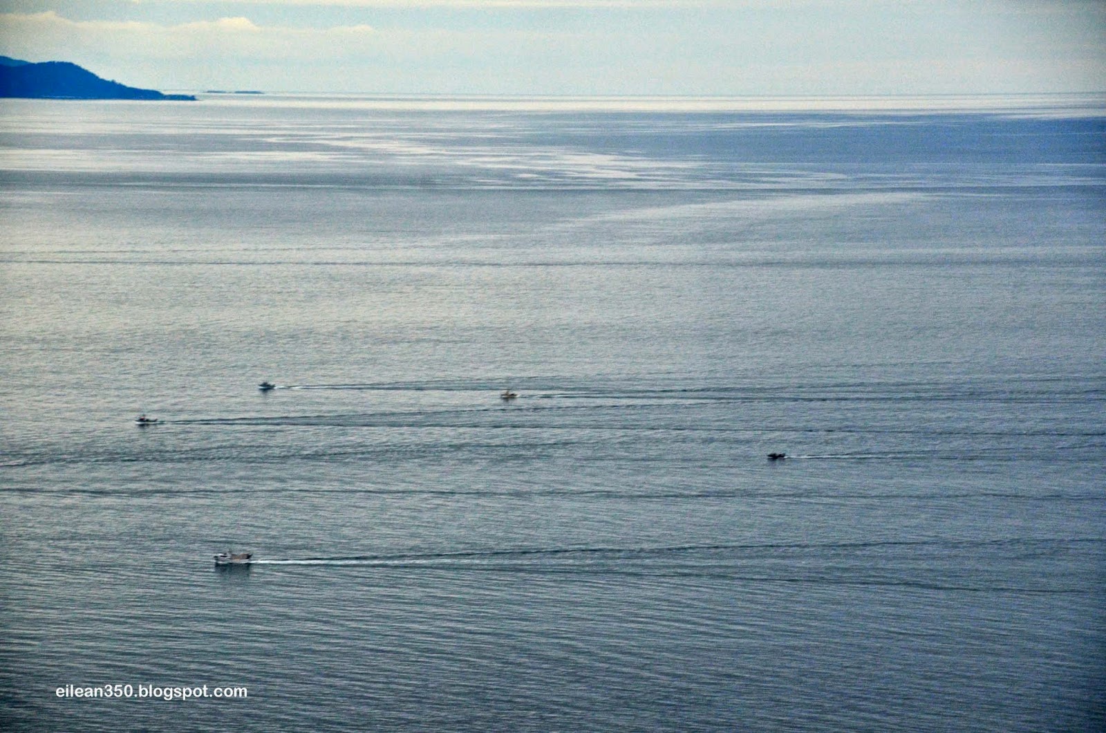
At one point I counted 35 boats heading to port.
No doubt they were loaded with fresh caught Halibut.

The late night sun painted the distant peaks with an orange hue.
A great way to end the day.


Yesterday we moved about 70 miles north to Soldotna.
Rather than try to go further north on the Kenai, since it was the weekend and
the King Salmon are running we thought it prudent to find a place to spend the weekend.

Our campsite is under the departure of the Airport and we've enjoyed watching this
DC3 taking off.   The DC3 has been around since the 1930's.  During WWII it was
known as a C47 and was instrumental in helping us win the war.


Here in Alaska the collection of planes found at the local airport is incredible.
Small aircraft play a huge role here in the North where roads are scarce and distance vast.
I will need to do a future blog post on the aircraft.


Today we visited the Holy Assumpton of the Virgin Mary Church.
It is a Russian Orthodox Church and together with it's Chapel and Rectory,
are among the oldest buildings on the Kenai Peninsula.


The church is listed in the National Register of Historic Places.


Kate managed to find this little old lady using a walker, who had the key
to the church and gave us a personal guided tour.
She told us of the efforts to preserve the church and of the early days of the town.
We also received a quick primer on some of the aspects of the faith.


Below is the Church Chapel.  Below which is the grave of the first priest and original
builder of the church.


Just 1/2 a block from the church is the Cook Inlet.


Finally back in town it was time to try out my latest find.


The best Apple Fritters in the Universe they say...
The Cinnamon buns are divine...
We left with an arm load of goods and so far I'm happy to report that
its not hype - its fact. 
The Moose knows its stuff!


I have to keep reminding you that all of our experiences here are in the context
of these endless days.   
We have not seen darkness for over a month now.
Does the moon still exist?
Are the stars still up there?

The plants here have not seen darkness for longer than that.
They grow fast and large.


Today in Safeway a section of the front windows had blackout shades on them.
When I came around a corner all I could see was the dark windows and for a moment
I lost track of time and thought that I was looking out to a dark parking lot.
It was the oddest sensation...   you call it night.

It would be so strange right now to get on a plane and land somewhere in darkness.   
It's funny how quickly the familiar becomes the foreign.

We are headed to Denali now.
I know that at one point we will be out of touch for at least 3 days with no
phone or internet.  Perhaps longer.

It will be nice to get back out in the wilderness.

We are in a town of perhaps 4,000 people and it seems so large.
It was nice to drive down a road and not see a car pass for 10 minutes or longer.
The Kenai seems so populated after all of that.
Kate and I both miss the solitude.
The Yukon is calling.

Friday, June 27, 2014

How to plan a trip to Alaska (or anywhere else)

Ok...  I've had close to a dozen emails from folks over the past month or so
asking me how I planned and prepared for this trip so since it's a slow day
and I don't have a lot of pictures to post I thought that I'd tackle that question.

First...  from my perspective - going to Alaska is no different than going to
any other of the 48 states.   It's really no big deal.
It really isn't.

Just like my sailing buddy Hayden always says:
"the hardest part is leaving the dock"

If the thought of driving more than 500 miles from home intimidates you...  
well then - I can understand your apprehension.

If you've already been touring the lower 48 however... then its no big deal.
Just a bit further.
And more scenic.
and more remote.

Going to Alaska is really no different than going to Colorado.
You just need more time.
The rest is just fluff to make people think that they've
 accomplished something amazing.

If you know how to find stuff searching google then you can plan a trip.

For my trip planning - the first consideration always has to be my job.
Towards that end is the need for internet connectivity.

So first step was a bunch of google searches to find out who were the telecom
providers in Canada, looking at their coverage maps, what kind of service did they
offer, and what was the technology used.   (GSM vs CDMA)

Once I knew what I could realistically expect - and where - I was able to tailor
a route that would give me as much coverage as possible.

If you are not working - then this first step is unnecessary.

To develop an itinerary I first needed to find out just what was there to see up here.
So...  the easiest thing is to find out where all the touristy places are.  
Where do most of the tourists go?

To do this I ran google searches like "RV Trips to Alaska" etc.
I bookmarked all the interesting web sites for later reference.
Keeping all of your internet bookmarks organized is a big help.
I created folders by Province/State to keep it from getting out of hand.

I was able to look up the caravan companies (the ones that take 15+ RV's in one big group
to Alaska for a fee) and see what their itineraries look like.

Yup.. guys make a living taking dozens of people on Alaskan RV tours.
I honestly don't get that but different strokes I guess.

I looked at the cruise line Alaska itineraries.  
Where did they go when the cruise portion was over?

In the process of doing this I was able to come up with a rough list of the places that
I wanted to see and visit.
I would google each of these places and used all the relevant sources
of info such as chambers of commerce, trip advisor, blogs, etc to get
a list of what is there to see and do in each location.

Now, when we are on the road and pull into a town, I've already got
a list of at least 5 or 6 thing to do or see in each place and I'm ready to hit the
ground running.

Then it becomes a matter of stringing all these places together into an itinerary with
overnight stops.

I tried to find at least 3 or 4 possible places to stop each nite.  
This provides flexibility.  
I prefer to do all this homework before we ever leave home.  
That way when we are on the road I'm not spending my time doing the research 
looking for places to stay.
Instead,  I'm spending my time enjoying the fruits of my prior research.

I find campgrounds a couple of ways.

I start with the AllStays App for iPad and iPhone.
It lists thousands of public and private campgrounds.

Ones that look promising - I use RV Park Reviews to get an idea
of what others say about it.  When I see a really good - or bad - comment about
a place I see how many other reviews has the person made.   The person might be a competitor
trying to make the place look bad.  Or the owner trying to make it look good.

If there is a website for the campground I look at that too.

Now our taste is campgrounds is different than most RV'ers - we generally prefer less
services and more seclusion - like you would find in National Forest Campgrounds,
and provincial parks, but that's ok...  the process is still the same.

When I find one that looks promising, I put it on the list for further research.

Then I take those on that list and try to find pictures or blogs about them.

I will google the name of the campground and then click on "images" when google
returns the results.   I scroll over those images looking for ones that have a URL (web address)
such as xxx.blogspot.com  or xxx.wordpress.com

I know that those type addresses would be blog addresses 
and theres a high probability that they
stayed at the campground that I am interested in and posted a photo.
I might find out more relevant info on the blog.

Also - many times it turns out its a blog of folks going where I am going and
now I have another good source.  I can read their posts for more info.

I read many blogs like mine over the past two years.

Many times I'll use google street view to see what the area looks like.
Is it hard to get into with a 53' long rig?
It's amazing how many places are covered by street view.

Doing this research of campgrounds has served us extremely well in the past.
We are almost always very happy with our overnight choices.

So...
I now have a rough idea of the route that I want to take,  places that I want to see
along that route, and many potential places that we can stay that would meet our
particular campground criteria.

Next I make a rough schedule.
I use iCal on my Mac.
You could use outlook Schedule on a windows machine, or any
other calendar program.
I do this simply because we do not have unlimited time.  We are not full-time
RVers and have other commitments.  If I was a free range chicken just wandering
around full time the schedule would be unnecessary.

To put together our schedule I enlisted the aid of google maps.
I created daily trips trying to keep the driving time around 4 hrs.
Stringing together places that I want to visit, matching it up with campgrounds,
matching it up with internet availability, making sure that there would be places 
that I could dump tanks every week or so...
slowly I was able to put together a day by day itinerary.

The places that have a lot to do - I allow more time.
3 or 4 days perhaps.

Then each week I throw in an "extra day"
This last point is important.   It allows flexibility.

When I was done with my planning I had a day by day schedule that listed
drive times, distances, several places to stay, and things to do.

If we change the schedule, all i had to do was drag all the places around to reorganize.

On a trip as big as Alaska, there is so much to see and do that having a schedule
to refer to at least allowed me to see everything that I wanted.

It would be real easy to stay in many places along the way and all of a sudden
you would run out of time and be scrambling trying to figure out where to go next.

All of those places were also programmed into my Garmin GPS using
Garmin Base Camp.  When I left home I had all the ground work complete
and was able to concentrate on having a good time.

So.... that's a real short synopsis of how I put this trip together over 18 months or so.
Was all the work required?   
Hell no.   
If you want you can just jump into the truck and hit the road.
I believe you will still have a great time.
The secret is just to get out there and do it.

I do believe however that the more thought and planning that goes into the front end
results in a smoother and more fulfilling trip on the back end.

If you require full hookups and pull thru spaces...
If you complain if the camp roads are not paved..
If you insist that the campground grass be mowed...
If you don't like getting lots of dirt on your rig, and chips in your paint...

Then its not for you.

But if you like some mud on your boots and
the smell of a camp fire in your clothes...

If the thought of driving a road where a car only passes by going the other way
 every 10, 15, 20 minutes or so...

Then this just might be for you.

There are plenty of places to get fuel.
You don't need a truckload of spare tire and spare parts.
The road is fine.
The scenery is breathtaking.
The wildlife is everywhere.
The days are long.

Plan or don't plan.

Just do it.

I hope that this helps.


Wednesday, June 25, 2014

Goodbye Seward - Hello Homer

Yesterday was our final day in Seward.
As usual - we did not waste a drop of it.

The day begins early not only for me, but also for the working boats.

Below a sport fisherman leaves port just as the sun is cresting the mountains.
If you look closely you'll notice a pair of otters cruising the bay as well.
Do you see them?


As the day matured the outlook was for another beauty.


So it was time to hit the trail.

While Dave opted for a serious hike - 8 miles and 3500 foot vertical up onto the ice field,
Ron & Maxine plus Kate and I took less extreme hike to the foot of Exit Glacier.


Our hike was about 4 miles round trip and a 500' vertical.
If you look lower left you can see Kate in the photo.


Up at the foot we paused for this self portrait, then we headed back down.


By the time we returned to our RV's the winds had picked up on Resurrection Bay 
and the kite surfers were out in force.

Wet suits are a must in this cold water.


The photo below - taken at 9:45pm - shows the boat that we took on our whale watching
cruise (6pm - 10pm)  returning to port right on schedule.


We had our own wildlife viewing right from the back of the RV.
This Sea Doodle was close to shore and made for a great photo opportunity.


This morning we picked up camp and headed 160 miles over to the west side of
the Kenai Peninsula and the town of Homer.

Along the way we stopped for a rest stop and Ron took Missy for a walk.


Missy is 16yrs old, deaf and blind, but still gives Gracie and Lucy a ration of crap
when they infringe on her space.

Last week after traveling over the Top of the World Highway she was crying and
having a hard time walking and we were afraid that her days might be numbered,
however she has bounced back better than ever.

We think the rough roads just jostled her old bones a bit to much and she was simply sore.

Our new location for the next two days is the Baycrest RV Park just 3 miles north of Homer.
What a beautiful location!
If you click on the interactive map "where are we today" (top right)
you can see our path today and we we are now.

John & Dave decided to go down the hill into town and camp with the masses on 
the Homer Spit, but we opted for the view and the quiet up here overlooking the bay.

We are high up on a bluff overlooking Kachemak Bay and the view
from the back window is to die for!


Our back yard...  a 180 degree panorama of stunning beauty!


The view from my office window.
We watch fishing boats far below coming and going up the bay.
Far across on the other shore are snow capped peaks and volcanos.


And just when we thought it could not get any better I spotted several Bald Eagles
that were patrolling the bluff in search of prey.


Meanwhile the park - and this area - are loaded with these beautiful purple
flowers.  I'm not certain but I'd guess they are in the Lupine Family.
So for now I'll call them Kenai Lupines.


Each time I think we've found the most beautiful spot and then we keep
surprising ourselves and find one even better.

I can't imagine getting a nicer view that this....
But then again - I have a few more tricks up my sleeve.
Stay tuned.


Monday, June 23, 2014

Seward, Ak - A trip to the Aquarium

Well - sort of...
On Sunday we said goodbye to Williwaw Campground and
took the beautiful 80 mile drive south on the Seward Highway to Seward.

We were sad to leave Williwaw but our schedule was starting to tighten as
we had used up our extra days that were built into the plan thus far and were
back on schedule...  we have reservations in Denali National Park that are starting
to loom on the horizon - June 30 thru July 4th.

Our home for the next 3 nights is the Seward Town Campground - called
"Waterfront Park".   It is a mostly gravel area located directly on Resurrection Bay
and has both unserviced sites as well as some with electric and water.

We chose the unserviced sites as they were $15 vs $30 and we really don't need the
water or electric anyway as we are perfectly set up for boondocking.

These long 20hr days are allowing me to make way more power with the solar
panels than we can even dream of using.  Even when its cloudy - as it often is - the
panels are putting 20 amps or so into the batteries.  When the sun comes out
I've seen the controller max out at its' 60amp limit several times.    Sweet!

Our site at Resurrection South and the view behind us.


Last night we tore into our coupon book again and booked another cruise.
This time it was a marine wildlife dinnertour from 6-10pm and again we were not dissapointed.

We had our own table and again had a Salmon and Prime Rib Buffet.
We convinced John and Dave to get the Magic Coupon Book and so last night they joined
us on the trip.


Our first sighting was another Bald Eagle.
It was far away and I got this shot using my telephoto.
If you enlarge the picture it's sitting in the tree in the middle of the photo.


Soon it was time for the Humpback Whales.

In this sequence below you can see how they first surface and exhale.
Note the spray.


Then they arch in preparation for their next dive.
You can still see the spray drifting behind it.


Finally - a wave good bye as they dive and disappear for 5-10 minutes.


Years ago Kate and I sailed a 38' Beneteau  in the Sea of Cortez in Baja Mexico and had
whales right next to the boat.  Close enough that we could have stepped off onto their backs.
When they would exhale we would get damp from the spray.
Let me tell you....  its stinks BIG TIME.
If someone says you have Whale Breath...  that's not good.

For me - one of the highlights of the trip was the Puffins.
I just love those goofy little birds.


Sometimes the puffins eat so much fish that they are too heavy to fly.

Next we saw a pod of Orcas aka Killer Whales.


Next were some Stellar Sea Lion.
Larger than their California Cousins, the Stellar Sea Lion is currently being researched
extensively to try and determine why their numbers are declining to critical levels.

This group was "hauled out" onto the rocks adjacent to a Kittiwake rookery.


The Kittiwake is a type of gull found in the North Pacific, North Atlantic and Arctic Oceans.
It forms large rookeries and it the only type of gull that is exclusively cliff nesting.


Our last sea life spotting was of a slightly different type.
The MV Statendam - a Holland America Cruise Ship had been in Seward when
we arrived and departed while we were on our cruise.

We also saw the Statendam while we were in Skagway


We also saw Dalls Porpoise on the trip but I was not able to get photos
as a large slab of juicy medium rare Prime Rib was blocking my cameras view.

So far the total for our Alaska Tour Saver Coupon book:

Venue                                                       $ $aved

Portage Glacier Cruise                                    $  34.00
Blackstone Bay Cruise                                    $138.00
Resurrection Bay Cruise                                 $ 79.00

Total                                                                  $251.00

Book Cost                                                        $ 99.00

We are in the Black by $152 and counting.

Not a bad deal eh?
I would not have know about this without Dave & Linda.
Thanks guys!


Friday, June 20, 2014

Prince William Sound... or OMG - Kickiin it up a notch

Today we took a 4 1/2 hr cruise on Prince William Sound.
If I said OMG those Glaciers were just sooooo awesome would I sound
too much like a "valley girl"?

Come-on Lindsay - the valley is in your neck of the woods...
I don't know how to describe today without starting to squeal like a tini bobber
at a Justin Bieber Concert.

It started out with our first sighting of a Bald Eagle.
This pix was not the best since I had to move quickly - but if you zoom in....

(PS - don't forget you can click on the photos to see a larger sized image.)


Our cruise today was another coupon out of the tour saver book.
Ka-Ching....  (sound of cash register)  another $119 Saved.
Two for one cruise and an all you can eat Salmon and Prime Rib Buffet to boot!

15 Minutes after departing the dock, and getting thru the prerequisite safety
announcements, it was time to eat, while we cruised up the sound headed
towards Blackstone Bay.

All around us was beauty and majesty beyond words.

Our interactive map (top right "Where are we today") shows our cruise out of
Whittier and into Blackstone Bay on PW Sound.
Click on it to see our route today.


Since heading north out of Montana, if there is one thing that we have noticed.
it is the absolute abundance of water everywhere.
Alaska is no different, here the streams flow everywhere.  
Coursing down the mountainsides in hundreds...
if not thousands of waterfalls.

The sea birds thrive in this habitat.


About 1/2 into our voyage we began to see the main event.


Up close to the Beloit Glacier you can see Kayaks below the 500' face.


Up close with the Kayaks.


Here (left side) you can see a small amount of ice "calving" from the face.


A closer shot of the calving.


More waterfalls.   The snowmelt runs clear.
The glacier melt is silted due to the fact that the Glacier is carving
and pulverizing the rock as it slowly moves.


For perspective - a tour boat below the face of the Blackstone Glacier.


At the base of the Glaciers, the Captain would shut off the engines and give us the 
opportunity to hear the Glacier.  That was an amazing.  These
massive mountains of ice...  moving mountains as they progress...  groan under their
own force.   The sound is as if the very earth is speaking.  It is a deep sound that you not
only hear...  but feel as well.

Moving up the bay you can see the massive ice cap - thousands of feet thick.
It is this ice cap that pushes down on the glaciers.


Again...  more streams coursing down the mountains at every turn.
They were so beautiful to watch with the binoculars.


Another longer range shot of the glaciers.


Later, we enjoyed another treat...
A raft of Sea Otters.
(or Sea Doodles)


The Sea Otters are unique in that they do not have the thick layers of blubber like
other marine mammals - rather relying on their fur to keep them warm in these
frigid waters.   The Sea Otters spend their entire life in the sea...   eating, sleeping, playing.


Approaching the end of our cruise in Whittier.
Our campground is just behind the dark "V" in the middle of the picture, below the Glacier.


For my sailing buddies....  this is some pretty - but cold cursing grounds.
The weather can change on a dime...  it is changing right now as I write..
The "Williwaw" is the name for a fierce polar sea storm or wind that blows from
the mountains...  it is also the name of our campground and the Williwaw is
starting to kick up tonight.

Below - it looked like a 25' or so day sailor like an O'Day.


We took over 500 photos today, and I just don't have the steam left to try
and pick the best so I just grabbed a handful to pass along.

I hope that you enjoy but....

I can't relate how poorly these photo convey the actual scenery.
As I looked thru the lens I kept thinking "this just can't be captured"

At least not by me.

Its hard to describe this place.

The magnificent beauty envelops you here. 
It towers over and engulfs you.
It gets inside your head and explodes.
You see it...  you smell it...  you feel it.

Its a big place...  in all ways.