Tuesday, August 26, 2014

The loneliest highway in America

Travelers headed east from the Reno - Tahoe - Truckee area have a couple of
options as to which way that they will go....

The road most traveled is Interstate 80.
As a matter of fact, most GPS's and mapping programs will likely send you down
that long boring stretch of interstate.

Another option however - and one that I have taken many times is
US 50 thru Nevada and Utah, where it eventually will join with
Interstate 70 headed east.

The map below shows the path that we took from Donner Memorial
State Park in Truckee, Ca to the Glenwood Springs, Colorado Area.


US 50 was named the Loneliest Highway in America in 1966
by Life Magazine.

It received this distinction due to the long long stretches of road without
any towns or services of any kind.   As a matter of fact, in the stretch between Fallon NV
and Delta, Utah - about 400 miles - there is only one real town of any size. (Ely, NV)

There are two others that have gas stations - so perhaps 3 towns in 400 miles.

What it lacks in services however it pays back in beauty and solitude.
We were making miles while driving US 50 so most of our pictures are shot thru
the windshield but you can get an idea.

We said good bye to Donner Memorial State Park.
This was the view behind our campsite.


We descend into the Nevada Desert and pick up US 50
near Fallon, NV, which is incidentally the home of the
US Navy Top Gun School.


The is the "Basin and Range" Country.
Numerous Mountain Ranges that run north to south, with big valleys
in between.

Running east to west you cross one mountain range, then down into the next
valley and up the next mountain range...  etc etc.


Some stretches you can see the road running straight ahead for 15 miles or so.
It's wide open beautiful country.

We spent the night in Ely.
It was thunder storming and we didn't get any photos that night.


The next morning we hit the road again headed east.
Leaving Nevada behind and entering Utah.

When you hit Interstate 70 in Utah you get to run what I think is
one of the prettiest stretches of Interstate to be found...
The stretch between Salina and Green River.
This stretch is one of the few interstates to be designated a scenic byway.


Seems like the scenery changes about every 20 miles on this run.
This is looking back towards where we came from.  You can see the ribbon
of I70 in the center foreground.


Here the highway descends from the San Rafael Swell.
The route down this canyon has been called one of the most significant
highway engineering feats of its time.

At points the canyon walls were close enough for one person to reach across and
touch both walls before the highway was built.

The walls of the canyon contain one of the largest know collections of
Jurassic Dinosaur remains.


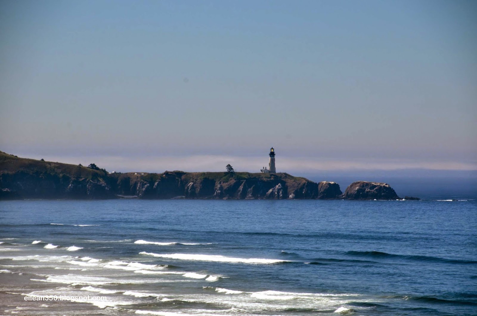
Further down you finally cross into Colorado and eventually
enter the beautiful Glenwood Canyon.
The roadway in this section was not even complete back in my days
as a trucker.   It was still a two-lane thru the canyon.


  1.  Our reward for the second night was this campsite on
  2. the Colorado River.


The shot below gives you an idea of some of the tools that I have at my disposal.
On the lower right I have Satellite Weather Radar.
I get real time radar (the mode shown)  or actual real-time weather maps.

These come in very useful when making runs in marginal or winter conditions.
On this trip I've used the maps to change my route and avoid some real serious weather.


Last night we had the most amazing night.
About 3 am we awoke to thunder and lightening.
There were actually several flashes of lightening per second, and this lasted
for almost 3 hours.   I have never experienced such a concentrated and long
lasting series of storms such as this.   All during this time the rain came pouring down.

I got up and checked for any warnings to make sure there were no tornados headed
our way.

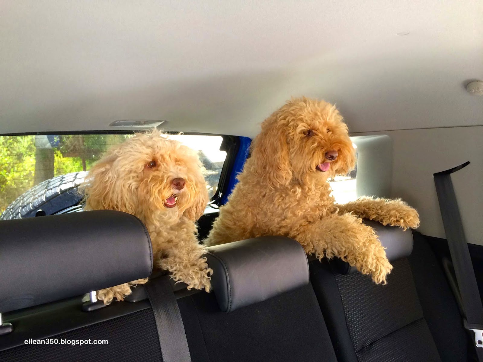
Meanwhile the poor Doodles were not happy about the Booming of the Thunder.
Especially Gracie who really does not like it at all.

Oh well...  its tough to be a Doodle.

Thursday, August 21, 2014

Donner Pass

The story of the westward emigration of the American Pioneers in the
mid 1800's would never be complete without talking about Donner Pass
in California.

Even today, truckers speak of the pass in winter with a sort of reverence and awe,
yet when one looks back in time it takes on an even greater prominence.

It was here in the winter of 1846 that 37 of the original 81 
Emigrants in the Donner-Reed wagon train died.

After taking an unproven shortcut that wound up costing them
precious time they arrived at the east face of the Sierras too late.

Over the winter half died, due to starvation after becoming snowbound
at Donner Lake and the nearby Alder Creek.

Our campsite is right at Donner Lake and a stones throw
away from where some of the cabins were.


Below is Donner Creek which flows gently from the lake.
It would have provided a ready water source.


Today a recreational asset...  A Far cry from 1846.
Beyond the lake and to the left you can see the low pass in the mountains...
It was here that the emigrants where headed for.
After making that pass it would have been
mostly all downhill the final 60 miles to civilization,
but it was not to be...


Arriving at Donner Lake they slept for the night.
That night a halo around the moon predicted bad weather...
The next morning the pass was covered in 5' of snow.
An early Fall snow had blocked the pass.
Still they tried to move their wagons over the pass but had to turn back.
Here is the view back towards Donner Lake from up top on the pass.


Soon a 4' snowfall down in the valley prevented movement in any direction.
By January over 22' of snow had fallen.
The monument below was erected in 1919 in honor of all the pioneers who opened up the west
It was placed in the exact spot where the Breen Cabin Stood.
The pedestal is 22' tall - the height of the snow that winter.


I think the plaque captures the spirit of these incredible people.


Below - about 150 yards from the Breen cabin is this rock.
The rock formed the north face of the Murphy Cabin.


Several miles away at Alder Creek, the Donner Family was first halted by a broken
wagon wheel and then the snow.
There was only time to build a makeshift lean-to against this tree.
24 people were crammed into this small enclosure that was supposed to
protect them from the brutal Sierra winter.


Of the 24 who encamped here - half perished.


 The story of the Donner Party is only one of thousands that make up the history
of the great migration.


The route the Donners tried to take was the best way thru the 
formidable east face of theSierra Nevada Mountains.

This was not lost on the railroad builders who followed.

The Transcontinental Railroad which was completed in 1861 followed this path
across the mountains too, and it was also for this reason that we came here to visit.

The rugged terrain and harsh winters (Donner pass averages 60' of snow per year)
presented a host of challenges.

With brute force and sheer determination they blasted and inched their way
eastward over the sheer cliffs and solid granite.

Snow sheds where build over the tracks so that the trains could run in the winter.

Kate and I climbed up the mountain to walk the old rail beds.
Here we are leaving one tunnel and looking at the next.


Thousands of Chinese Laborers make this railroad possible.
Below is the Chinese Wall - thousands of tons of rock piled up to create an
embankment to hold the railroad bed.


Today some new artists have added their touch to the walls.


Standing in a snow shed and looking into a tunnel.


Looking down to where the truck is parked.
Can you see it in the center of the photo?


 A view of the snow sheds along the mountain face.


Almost 40 miles of snow sheds where constructed to allow the trains to traverse the pass.
Today they are made of concrete but are still needed.

You can now traverse Donner Pass by Auto in a matter of 30 minutes or so...
But in winter the snow still can shut down the pass as the snow piles up.

Still the voices of those early pioneers and then railroad builders
are not too far under the surface.

Its hard to be here and not hear their cries.

Later - one of the survivors - 12 year old Virgina Reed wrote to her cousin back east:

"Oh Mary I have not wrote you half of the trouble we've had,
but I have wrote you enough to let you know what trouble is.

But thank God, we are the only family that did not eat human flesh.

We have left everything, but I don't care for that.
We have got thru with our lives.

Don't let this letter dishearten anybody.
Remember, never take no cutoffs and hurry along as fast as you can.


Wednesday, August 20, 2014

Goodbye and another Switcheroo.

Well another 2 weeks have gone by.
We've said good bye to our Swiss Friends, Moved the Montana
and the dog house, visited with Ron and Maxine,
and now are retracing the steps of the Donner Party.

To Catch you up....

We moved inland from the coast to Woodburn Oregon.
Our friends then took advantage of the outlets to stock up on clothes to
take back to Switzerland.
A couple of hard core shopping days ensued and then it was time for us to say goodbye.

We had to head south with the doghouse and they headed to Seattle to catch their flight.

Meanwhile Gracie has been doing some of her own flying.
She jumps from the Dinette Area to the bed in the DogHouse.

Take-off


At Cruise Altitude. 


Finally - The 4-point landing.
Doodle Aviation at its finest!


Leaving Woodburn, we took the DogHouse 7hrs south to Red Bluff, Ca.
Then we drove empty 10hrs north to Cle Elum, Wa to retrieve the Monty.
Then it was 10hrs back to Red Bluff with the Monty.

Here they are side by side again at Red Bluff.


We then took the Monty 3 1/2hrs south to Placerville to put it in storage.
We returned to Red Bluff the Same day and spent the night in the DogHouse.
The Following day we drove back to Placerville to spend a few days with
Ron & Maxine at their home.
Once done we had clocked over 2,000 more miles on this trip.
Our total is now more than 18,000 miles logged since April.

Going to Rons place is like a visit to the antique car museum.
He is an avid auto restorer and quite good at it.

His current project is a 1975 Corvette (hope I got the year right Ron)


He does it all and does it to exact standards on the Vette.

Down to little blue dots of paint on certain unseen bolts.


One of his completed projects is this 1955 Chevy.


The chrome detail on these old cars is really cool.
It shines like new and is spotless.   And i mean SPOTLESS!
This car is not to original specs however.


It is powered by a 1970's era Corvette computer controlled V8 engine with about
twice the horsepower of the original engine.


Here is the 55 on the lift in his garage, the corvette hood in the foreground.
If you haven't noticed - his garage is gigantic, well equipped,
and spotless. 


While visiting Ron & Maxines, and enjoying their hospitality we visited some of
the local sights.
Below is at Sutters Mill, where gold was first discovered in California.
The discovery of Gold in California was a pivotal event in the history of the USA.


The Doodles traveled around with us everywhere and also had a
great time visiting.


We toured an inactive hard rock gold mine and posed for this self portrait
over 150' underground.
It was right around this time that I mentioned to Kate:
"I hope we don't have an earthquake right now"
Her response I cannot print.


A view of the mine shaft.


We spent 3 nights with our buds but as usual it was time to move on.
Tuesday we headed east on US 50 and crossed the Sierras to S. Lake Tahoe
and then went up the east shore of the lake.
That was a beautiful drive for our next blog.

We are now at Donner Memorial State Park in Truckee, California.
It was here where the Donner Party became snowed in and stranded just 60 miles short of
their destination in the Sacramento Valley.

This area is full of history and needs to be given more time in order to present 
it properly so that will be for our next post.

Till then.

Friday, August 8, 2014

The Coast

Another week has slipped by since our last post.
Another busy week for sure.

Arriving in Crescent City California, we spent a few days seeing the local sights:

The Crescent City Lighthouse


The BIG Trees in Redwoods National & State Parks 


We took a great hike among the giants


Franchesca is dwarfed by one of the smaller trees. 


We had to watch out for the wildlife along the way.


Isabella tried on my sunglasses for size.


Of course each night we had a campfire.
Sometimes accompanied by steaks over the hot coals.


Believe it or not - in all my decades of camping I have never cooked steaks
directly over a wood fire.   This was a new one for me.
The steaks were awesome!
There were more on this trip and there will be more to come.

Our daytime excursions as we headed north along the Oregon Coast
always included some Beach time.

Even with the cold water (perhaps 50 degrees) the girls and I
found time to get our feet wet.


Our overnights along the coast in Oregon consisted of the following State Parks:
 Bullards Beach State Park
 Jessie Honeymann State Park
Sunset Cove State Park
and Devils Lake Sate Park.

At Bullards Beach we visited the Coquille River Lighthouse


We walked a couple of miles to the beach and back.


Kate found another item to put into the DogHouse.
This piece of wood is to become a fish according to Kate.


Our next night was spent at Sunset Cove State Park.
In the morning we visited Cape Arago State Park and
Shore Acres State Park, all three of which are located next to each other.

Below is the Cape Arago Lighthouse.


Shore Acres State Park is located on the former estate of Timber Baron
Louis Simpson.   The estate and its beautiful gardens were originally
constructed in the early 1900's however the stock market crash and a massive
fire devastated his holdings and the estate was sold to the
Oregon State Parks in the 1040's.

The entrance to the gardens.


The mansion stood above the Pacific and enjoyed an awesome view


The variety of the flowers were amazing and they change throughout
the year. 

This is just a small taste of the visual feast that we enjoyed.


North of Newport we stopped for lunch in an abandoned dirt area at the top of cliffs.
To our south was the Yaqina Head Lighthouse.


Mom and the girls share a moment.


Further up the coast near Florence we visited the Sea Lion Caves.
The Sea Lions were not in the Caves, but they were on the rocks.
These are Stellar Sea Lions - the same type that we saw up in
Alaska outside of Whittier on our Glacier Cruise.


Next to the caves is the Heceta Head Lighthouse...
Supposedly the most photographed lighthouse in the world.
It certainly is a pretty one!


Our coastal tour concluded with a tour of the Tillamook Cheese Factory and
of course some Ice Cream Cones.

After our final night at Devils Lake we headed inland to just south
of Portland, Oregon where we are now.
The ladies will spend a few days shopping and visiting the Outlets.
I hope to visit the Evergreen Air and Space Museum.

Our time together is winding down...  How fast the time passes.
In just a few more days we will be heading south to drop off the Dog House
then back north to fetch the Montana and once again start the
DogHouse/Montana Shuffle to get the RVs positioned
for next winter.   Then we'll head east in the DogHouse.
(remember that dance?)

Our friends will head north to Seattle to drop off the rental RV and
catch their flight back to Switzerland.

But thats not just yet.

That is all for our next post.